

The Goldfields Trip Jan 2013
The aim of this trip was to spend a few days wandering around the Victorian goldfields area in search of free camps and low-cost campgrounds. We were rather new to caravanning and, in those days, finding a campsite meant flicking through the rather cumbersome Camps Guide. The plan was that once we’d had a mosey around, we would meet up with our friends R & T in Clunes on Tuesday, January 15th, as R would then have completed his cycling at the Ballarat Cycling Events. The best-laid plans of mice and men….
Thursday 10th January 2013 Home – Bendigo, hot
It’s a fine day, around 21 degrees and we are in no rush, we hitch up and cruise off at 11:15. With each trip, we learn a little more and after our Broken Hill holiday our second with the van, we had decided that we needed more in the way of maps than our 20-year-old Australian Atlas and our two Camps Guides, oh and of course Google Maps on the iPhone, which helped us with the city streets in Broken Hill. We now have our new Garmin GPS plugged in and it has been updated with the most recent maps as well as the Free Camps from the OZ Camps website, which show as Points of Interest on the GPS. Wow, there’s nothing stopping us now! Whoops, she’s even directing us around our own suburb, this is a little disconcerting, “no, we are not going through that intersection with a caravan behind, we’d be mincemeat in a flash”.
A quick stop to put air in the tyres and we’re onto Eastlink, the Monash Freeway, Tullamarine Freeway then Calder Highway. In fact, it only takes one hour to get to the Calder Raceway and we haven’t had a traffic light since we left home, these new roads are great. We stop at Kyneton to stretch our legs with a stroll along historic Piper Street, we buy bread and some curry pies from Grist Bakery, and we munch as we drive. Before we know it, we’re in Bendigo, funny how the drive appears quicker when you aren’t in a hurry.
We buy a few groceries to stock up the fridge, giving it more to do than just keeping the beer cold. We tell Gabby (she talks far too much) Garmin that we want to go to the Shadbolt Campground in the Whipstick Forest and suddenly we are off on a scenic tour of the housing estates of Bendigo, and we thought we knew this city well. Around in circles and back streets we go and then we hit a dirt road and we’re in the forest, we’re starting to lose our trust in her, so we ask a friendly local who agrees that the campground is just down the road that we’re already on. We find the Notley Campground first and it is a beauty, well-kept with marked parking bays, a BBQ shelter, and toilets, it would be a good spot to camp. We press on to Shadbolt, just a few kilometres away, but it looks tired and neglected, so we turn around. The day is now seriously warm and the likelihood of bush fires is extremely high, being in the middle of a heavily forested area, with 9kms of gravel road to negotiate is concerning, so we decide to head to our third choice Happy Jacks at Lockwood South on the Marong Bypass.
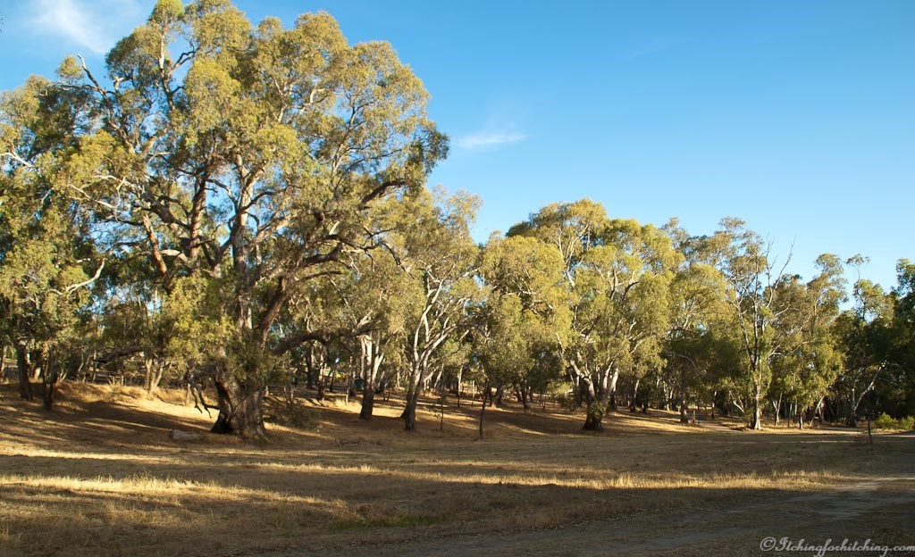
Once again Gabby leads us on a merry dance around Bendigo, down roads we never knew existed, and then quite surprisingly lands us at Happy Jacks, I’m sure she said “I told you so”! We first saw this rest area / free camp when we passed on our way to Broken Hill and it looked inviting in the spring and still does in the dry heat of a Bendigo summer, the camp has been mowed and the toilets are clean. It is far enough away from the traffic and there are lots of tiny birds in the trees and kangaroos feeding in the paddock behind us. We have another van for company a hundred metres away. We heat up a chicken casserole and sit outside with a glass of red wine, enjoying the summer smell of the bush. I bring out my ukulele for a bit of practice and as we’re singing a local chap and his dog emerge from the darkness to interrupt our tuneless warbling. At least he didn’t complain about the noise. We chat for a while about the state of the nation and hit the sack around 10:00pm.
Towing Kms: about 230kms

I do like your penchant for nicknames, but I don’t think I’ve ever seen yours.
LikeLiked by 1 person
Ukulele Lady.
LikeLiked by 1 person
Lovely
LikeLiked by 1 person
Gabby knows best – until she doesn’t!
LikeLike
I’d hate to have no direction skills and have to rely on the GPS. Sure as eggs it would try to kill you!
LikeLiked by 1 person
I know what you mean by Gabby Garmin – ‘make a u-turn if possible’ – over and over and over even though we kept pushing the ‘recalculate’ button to tell her we had made a slight change of plans!
We called the GPS system built into our Jeep ‘Adventurous Andy’ because it kept directing us to make turns that would take us ‘off roading’.
LikeLike
Oh, don’t they just love dirt roads! They almost beep with delight.
LikeLike
I’ve only used a “tell me how to get there” machine in a car once. Whenever I got into flat dairy country it started mooing, which was very annoying and I didn’t know how to turn the machine off. Four hours later upon arrival I found the instruction manual. Mooing didn’t mean dairy country; it meant I was driving too fast!
LikeLike
It was only caring for the cows Bruce.
LikeLiked by 1 person
Bull!
LikeLike
😜
LikeLike