

Day 6
Thursday 12th March 2015
Port Augusta to Pildappa Rock
Now that the wind has stopped, I can appreciate the view across the inlet to the Flinders Ranges. It is a shame that the view is spoilt by a high barbed wire fence. We are locked in a gated park due to the incidence of burglaries. Even the dump point has a fence around it, although I’m wondering what they could steal, poo perhaps? Despite the crime we are impressed by the town centre with its narrow, treed streets, plenty of shops and new wharf precinct. The locals are very friendly and even wish us a pleasant stay but that may have been influenced by little Tillie the poodle who does a good job of schmoozing everyone who passes with big licks and tail wags.
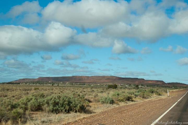
Minutes out of town and we’re in the desert with saltbush plains and low pink hills in the far distance. The tailings of Iron Knob loom large on our left and we detour to have a look. Mining has been drastically reduced and the town is little more than a ghost town now. Emu warning signs in the Main Street denote that things must be pretty quiet here. There’s a pub, bowling club and a general store. The houses are little more than rusting corrugated iron shacks but those in use have small gardens, pumpkin vines and other signs of occupation.
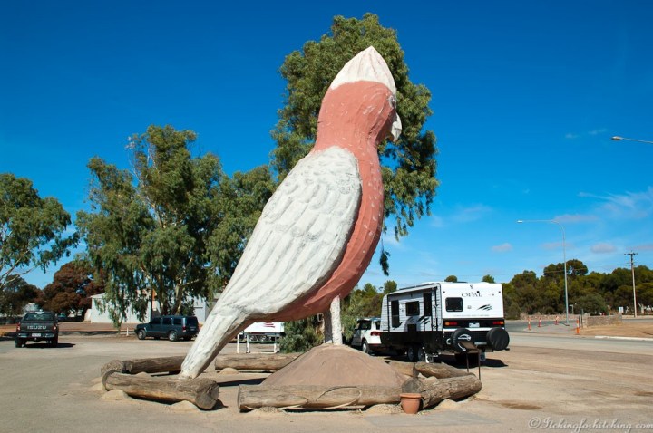
We drive through miles of mallee scrub before it opens out to magnificent plains of wheat fields. The town of Kimba has huge wheat silos and of course the Big Galah. The silos are in better shape than the old bird that desperately needs more pink paint. The Aussie flag flies proudly in the centre of town and people bustle about.
About 15kms off the highway at Minnipa, Pildappa Rock stands high and proud above the wheat fields. The Eyre Peninsula is known for its granite monoliths and Mt. Wudinna is 2nd largest to Uluru. Veewee finds a perfect campsite beside the wave face of the Rock and we constantly marvel at its size and the lichen stripes and patterns. This morning Woody had thought that we wouldn’t see another van like ours on this trip and yet here we have neighbours with the same van and a Jeep. Our other fellow campers are sprightly eighty year old retired farmers in a camper trailer. We climb the rock and watch the sun set over the wheat fields. David tells us what it is like to be bitten by a Clarence Valley Rough Scale snake and how his last recollection before drifting into a coma was the wonderful news that the farm had just sold!
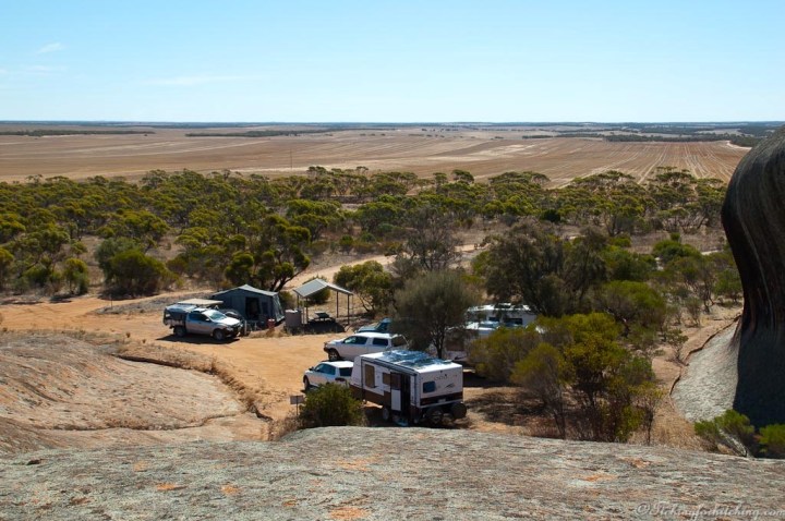
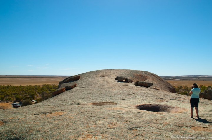

Note: Pildappa Rock has to be one of best features when crossing the Nullarbor, yet remains little known. We were captivated the moment we arrived and vowed to stay for two nights.


North of Pildappa Rock is the Gawler Ranges National Park, Mt Ive Station campground, and Lake Gairdner. If you have never visited these, put them on the must-do list for the time when this plague is over.
LikeLike
Will do Wendy we loved Pildappa. Thanks for the tip.
LikeLike
I’ve never heard of Pildappa Rock despite living in Minnipa for a long 14 weeks. I guess that’s what happens when you have no vehicle to get about the place so are stuck in the town.
LikeLike
Oh dear! It sounds like there’s a story in there somewhere. The joys of caravanning eh?
LikeLike
I was actually working there in the late 60s! Went from there to the RIverland, couldn’t believe my luck!
LikeLike
Gosh you would have been craving the sight of water by then.
LikeLike
The last photo is particularly good.
LikeLike
Thanks Derrick. Such an interesting place and so few people.
LikeLiked by 1 person