

Day 10 Tuesday 20/8/2024 Quorn to Laura, clear blue skies 11 – 18
We wake to a bright breezy day and take the Horrocks Highway south through Wilmington. We cross Goyder’s Line* at Melrose and instantly it is greener and lush with large gums and pastures. The town is inviting, but hey we haven’t been on the road long enough, if that makes any sense.
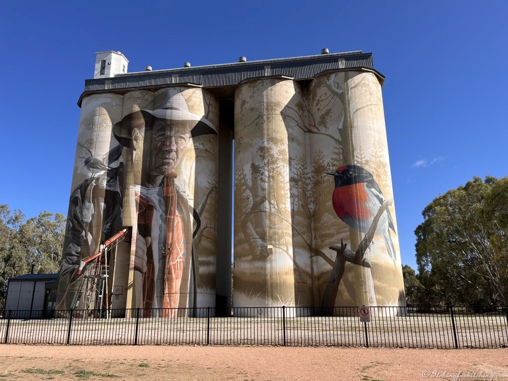
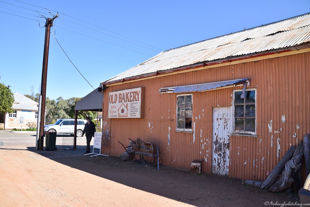
The Old Wirrabara Bakery though seduces us with its cheese and bacon bread and apricot scrolls. While Woody and Elle are in the bakery, I wish that I was a faster sketcher as an old farmer potters around, grey beard, flanno** shirt, a dusty old Toyota ute and a red Heeler as arthritic as himself. The silo art here has been painted by ‘Smug’ Sam Bates, the artist who did the birds in Dimboola and we stand there wondering for the umpteenth time at the talent of those silo artists. On we rumble, if only we’d bought a second loaf of that bread.
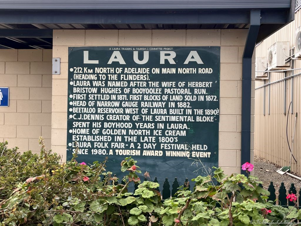
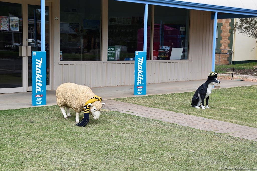
Laura is a welcoming town as the highway is flanked with an avenue of pepper trees and Kurrajongs. The Laura Community Caravan Park is a little beauty with a community garden that our grassy sites back on to. As we stroll around town the poodles Nic & Molly are perplexed by the plastic sheep and sheepdog outside the farm supplies shop. I guess they are quite realistic, but barking won’t move them. There’s one shop in the main street that has become a church and the sign in the window says, “Dunking biscuits and believing since 1875”.
Mid-afternoon the park manager drops by with a plate of freshly baked scones, jam and cream for us. What a nice touch. I take my scone over to the garden and enjoy it while sketching the old church on the next corner. A church that has morphed into an antiques shop. And while we’re on the subject of churches, there’s another handsome house of worship over by the park entrance, but this one is adorned with fairy lights and is called Small Blessings Brewery. At least the Lutherans across the street have still got a hold on their real estate. It’s a perfect afternoon for lolling about, Elle is knitting a rug, VeeWee can’t resist the ice cream shop in town, and Woody chalks up a few more steps for the day.

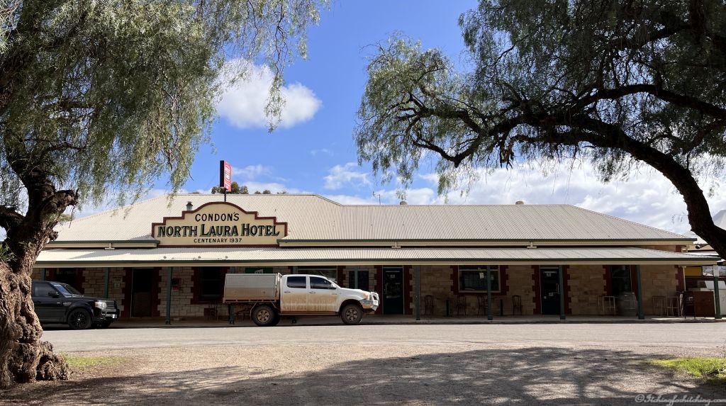
According to the socials the North Laura Hotel has a good reputation so we book a table and stroll up there for dinner. The publican is a man born to his job and quite a character. When we comment about him stocking our favourite wine Calabria Estate and also De Bortoli from Griffith he explains why. You see his de facto’s ex de facto’s de facto used to work for De Bortoli and now he’s working for Calabria Estate, or was it his de facto’s sister’s de facto, oh, I don’t know, but both the wine and the dinner are excellent.

Now before I go, remember the other day, VeeWee rushed into our van asking if vinegar could cure dandruff? Well, tonight over dinner Elle tells us that she was so relaxed this afternoon that she forgot to rinse the conditioner out of her hair and as she tells us this, she ruffles her hair, and it stands up reminiscent of Cameron Diaz in Something About Mary. VeeWee is nodding sagely and announces that she’s still doing the vinegar treatment. Is it any wonder that Woody is missing male company on this trip?
As we stroll back home, we find an old shop that makes anyone who is height challenged feel pretty good. The curving red veranda is so low that even Elle and I need to duck our heads.
Accom: $32.00, Towing Kms: 108Kms
*Goyder’s Line
With barely 30 years’ knowledge of this new country, farmers needed reliable information about the climate and growing conditions. In 1865 George Goyder, the then Surveyor-General of the colony, was asked to map the boundary between those areas that received good rainfall and those experiencing drought. After traversing an estimated 3200 km on horseback (not including the Eyre Peninsula) in November 1865, he submitted his report and map to the colonial government on 6 December. The map included a line of demarcation, the areas north of which being those Goyder judged “liable to drought”, with the areas to the south deemed arable. He discouraged farmers from planting crops north of his line, declaring this land suitable only for light grazing. Goyder’s report was based on the information already in his office, supplemented by the observations made during the 1865 journey to observe the effects of drought. He was guided in drawing the line by the changes in vegetation, especially various kinds of saltbush.
Ample rains fell in most years between 1867 and 1875, prompting farmers to ignore Goyder’s report and settle in the north, starting farms and planting crops. The idea that rain follows the plough, developed during the contemporaneous westward expansion of cropping in the United States, encouraged this trend. A few years later, many had to abandon their properties. The land was indeed unsuitable for crops, and Goyder was proved correct. Many farmhouse ruins can still be seen in the vicinity of Goyder’s line. Source: Wikipedia

**Flanno, flannelette checked shirt, a symbol of farming in the bush.
Unusual names: Yackamoorundie Creek.

oh yes, the scones are a bit of an institution in Laura
LikeLiked by 1 person
Gotta love that silo art. So many talented artists. Had a chuckle at the de factos and the De Bortoli but regardless it’s a good drop and one we drink often, even up here. And you can’t beat those scones!
LikeLiked by 1 person
Some people were born to be publicans. A sweet little town.
LikeLike
I can’t feel sorry for your other half when he has so many delicous eating opportunities.
LikeLiked by 1 person
🤣
LikeLiked by 1 person
Many of our churches have similarly morphed into Antique shops
LikeLiked by 1 person
Oh, so it’s a fashion it seems.😉
LikeLiked by 1 person
Yes
LikeLiked by 1 person
Perhaps if more places of worship were changed into antique shops there would be fewer problems in the world!
LikeLike
Less wars and more online antique auctions!
LikeLiked by 1 person
I want to visit Laura! Thanks for the great story. 🙂
LikeLiked by 1 person
A sweet town.
LikeLike