

Dec 2019, Albury / Wodonga
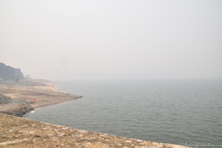
For those who are concerned about climate change or unfamiliar with the current bushfire situation in Australia these photos are of the Hume Dam near the twin cities of Albury Wodonga on Christmas eve this year. Bushfire smoke enveloped the area making my eyes sting just taking the photos and I was certainly not going to walk across the length of the dam wall. How far away are the fires? This smoke was probably from the Sydney fires still burning 550kms to the north. There is another large fire in Gippsland 310kms to the south east which started when we were in Lakes Entrance back in November and has now joined up with other fires.
What’s the yellow stuff in the foreground? That’s lawn or should I say that was lawn things are pretty dry here at present.
Other than a little horizon straightening as I am notorious for taking crooked photos, these images are untouched. Though I might add it was hard to see where the horizon line actually was.
The Hume Dam was completed in 1936 and at that time was one of the largest in the world. The capacity of the Hume Dam was further increased in 1961. It and a series of locks, dams and barrages controls the flow of the Murray River for agriculture. The Murray being the eighth longest navigable river in the world forms a border between the states of New South Wales and Victoria and flows to the sea in the state of South Australia.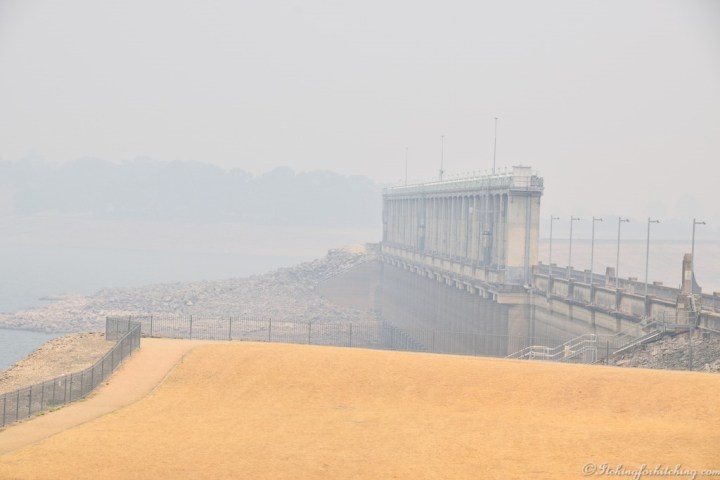


There was an interesting article in November about how these fires in Australia were started. While hot, dry and windy weather increases the risk of fires, only 6% of the fires are started by natural causes. The rest are caused by human activities, and almost half of them are arsonists!
LikeLike
Much of our populated coast has similarities to that of California and the same high chance of wildfire. Our greatest fear in summer has always been bushfires. Add to that an unrelenting long drought that has left the country drier than most can remember and record breaking temperatures across the continent. As you can imagine it only takes a spark to ignite an inferno. Lightning strike is a big factor, trees and power lines another. If I recall correctly, our state’s worst fires in 2009 which killed hundreds of innocent people was caused by the spark from an angle grinder. Then there are the arsonists, the foolish and the curious children playing with fire. It all makes for a dangerous mix. My heart goes out to the close to 1000 families who have lost their homes in the last four months of fires and our firefighting heroes. If anyone wonders what climate change looks like, it is here for everyone to see and it is ugly.
Sorry for the rant Margy but, travelling about the country in our caravan we have watched first hand how this land is shrivelling and dying. Now send me one of your amusing posts to give me a giggle!
LikeLiked by 2 people
I don’t know that much about Australia, so it was interesting to read about how droughts and floods are a consistent feature of the country. Here is an interesting history that takes the drought and flood history back 500 Years!
https://theconversation.com/500-years-of-drought-and-flood-trees-and-corals-reveal-australias-climate-history-51573
LikeLike
Very interesting indeed and so good to see what happened prior to records being kept. Yes, we certainly rock back and forth and it’s not unusual to have drought while elsewhere there are devastating floods.
LikeLike
Great photos, horrible conditions. I’d like to mention that we’ve had lightning strikes which also ignite bushfires.
LikeLike
Yes, and we can’t give those a rap over the knuckles.
LikeLiked by 1 person
🙂
LikeLike